माटूहमरू, पाणीहमरू, हमराहीछनयीबौणभी… पितरोंनलगाईबौण, हमुनहीतबचौणभी। (Soil ours, water ours, ours are these forests. Our forefathers raised them, it’s we who must protect them —Old Chipko Song )
The state of Uttarakhand, earlier referred to as Uttaranchal, is located in the northern part of India. Often called as the Land of Gods – Dev Bhumi owing to the innumerable temples and teerth or pilgrimage sites found throughout the state. The famous Char Dham (Kedarnath, Badrinath, Gangotri, and Yamunotri), considered to be the among the holiest sites in India, are in Uttarakhand. Besides the religious significance of the state, Uttarakhand is also well known for its natural beauty that comprises of snow capped mountains, both low and high altitude lakes and associated wetlands, bugiyals or high altitude meadows, and dense forests that are a home to many exotic and diverse flora and fauna.
The beautiful forests of Binsar in Uttarakhand (Almora)Beautiful view of snow peaks from Lansdowne in Uttarakhand (Pauri)
The name Uttarakhand has originated from two Sanskrit words: uttara (उत्तर) meaning north, and khaṇḍa (खण्ड) meaning land. The name is mentioned in many of the early Hindu texts, wherein it referred to the area of Kedarkhand (modern Garhwal) and Manaskhand (modern Kumaon). In ancient India, Uttarakhand was used to denote the central stretch of the Himalayas.
“The land north of Gangadwar is known to the wise as Paradise Ground. Apart from this land, the rest is called Earth elsewhere”― Kedarkhand Skanda Purana.
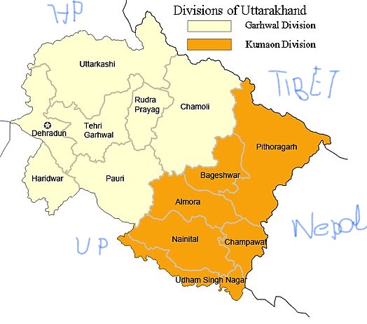
The state of Uttarakhand was formed on 9th November 2000, by carving out the Himalayan and some adjoining districts in the foothills of Uttar Pradesh, and was made into the 27th state of the Republic of India. It shares borders with the state of Himachal Pradesh to the north west, Tibet Autonomous Region (of China) on the north, Nepal on the east, and the state of UP in the south, while doing a touch and go with Haryana in the west (the Hathni Kund Barrage area from where the Yamuna waters are diverted to Haryana). Uttarakhand is the birth place of four large river systems: the Ganga, Yamuna, Ramganga, and Sharda. The state has two divisions: Garhwal and Kumaon with a total of 13 districts.
The entire hill state of Uttarakhand had remained culturally and socially united right from the ancient times, and the two tracts Kedarkhand (now Garhwal) and Kurmachal (now Kumaon) were mere geographical divisions. Kedarkhand was named after Kedarnath, and Kurmachal named after Kurmavana. The two regions were not culturally or politically divided and remained so even under the Katyuri dynasty that ruled from 800-1100 CE. It was only during the 12th century CE that two political divisions appeared, because at that time the Chand dynasty took control of the area now known as Kumaon, while the Rajas of Garhwal controlled the region of Garhwal. Despite the two different dynasties, the region remained united in cultural and social contexts.
Thus, it can be said that in the ancient times the entire region (as we find mentioned in the epics and Puranas) had stretched from the river Kali as the border in the east, and Tons river as the border in the west, Niti pass in the north, and Thakurdwara of the present Moradabad district in the south. For many years the people of this region enjoyed a homogeneity, in the context of social, cultural, and political lives of the common people. It was only the administrative units created in the 20th century that brought in the divisions and further changes.
My focus here will be on the Kumaon division of Uttarakhand.
Looking at Kumaon from a Geographical Perspective
Geographically Kumaon is located in a north west corner of North India, and its is well demarcated from its neighbouring states and countries by mountain and rivers. In the north it is separated from the autonomous region of Tibet by the snowy peaks of the Himalaya, in the east river Kali separates it from Nepal, and in the south the Himalayan foothills separate it from the plains of UP.
View of the Panchachulli from Munsiyari in Kumaon
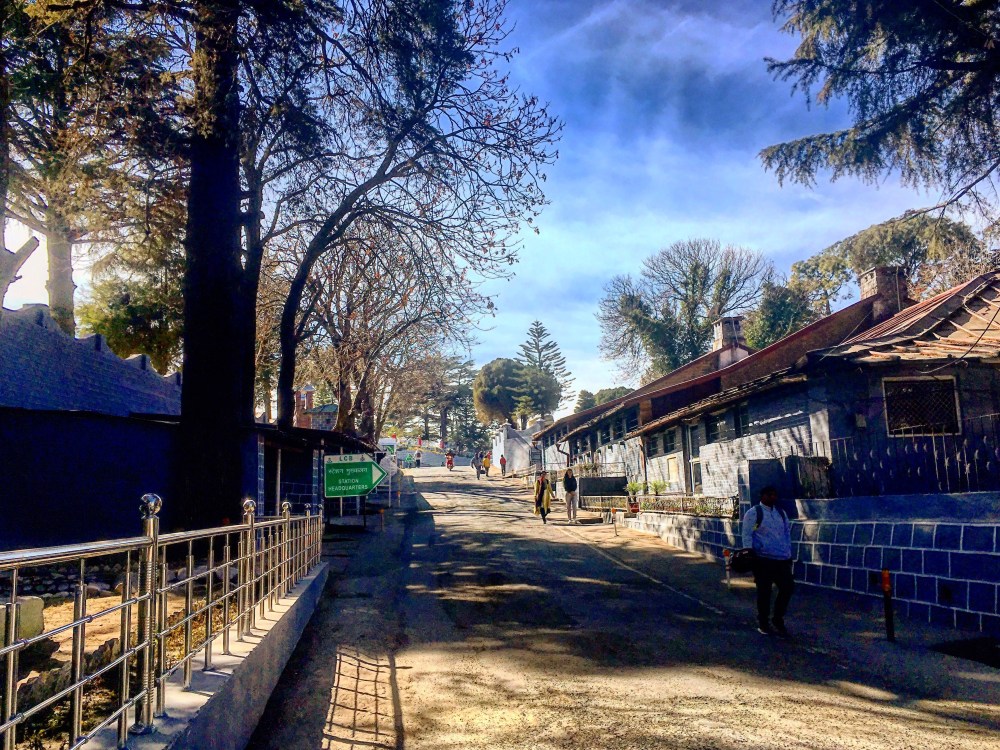
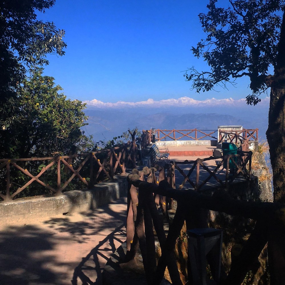
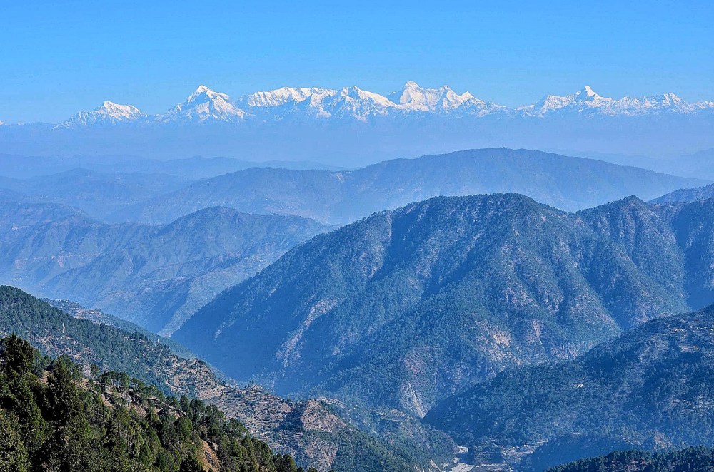
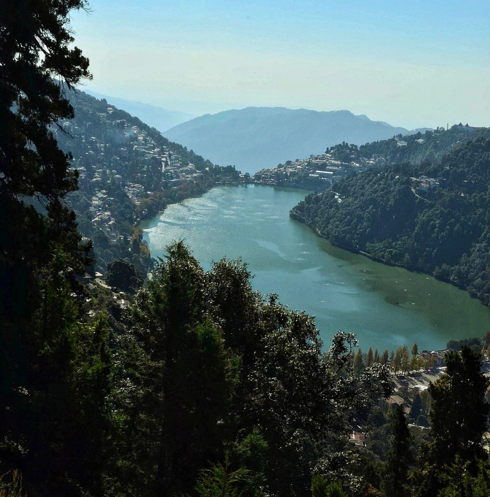
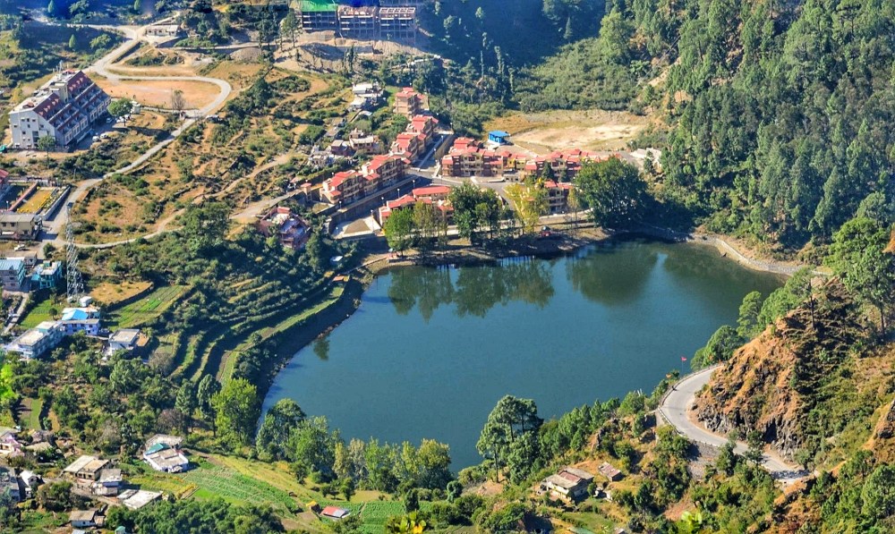
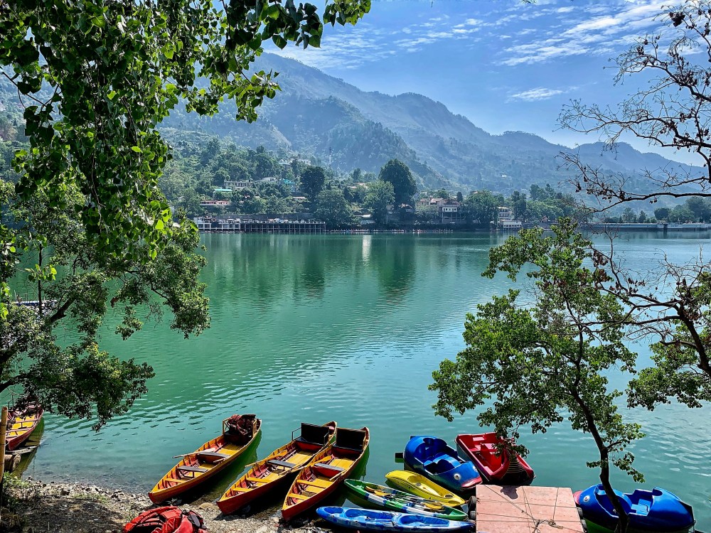
The Kumaon division rises sharply from the sub Siwalik (foothills) strip of land to the high snowy peaks with glaciers. The outer ranges of the Himalaya, a part of which is known as Gagar ranges, rises quickly from submontane tracts to 7000-8000 ft, where many of the famous hill stations, such as, Mussorie, Nainital, Almora, Lansdowne, etc., are situated. This part is especially beautiful with its densely forested parts; and when standing at the tops of peaks that often reach more than 8000 ft, the view is spectacular with plains visible on the southern side, and the endless waves of entangled northern ridges on the other side that is bordered in the horizon by beautiful snow peaks of the central axis of the Himalaya. The outer ranges of the Himalaya hold some beautiful low altitude Himalayan lakes, such as, Nainital, Bhimtal, Sattal, Naukuchiatal, Malwa tal, and Khurpa tal. It is believed that most of these low altitude lakes were formed by tectonic movements that blocked rivers during the Holocene period.
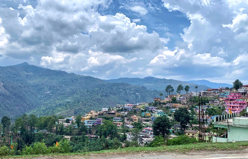
Almora townSpectacular views from the Gagar ranges (Nainital): endless waves of entangled northernridges bordered by snowy peaks of the central axis of the Himalaya in the horizon. (photo courtesy: Atanu Dey)Nainital. A low altitude Himalayan lake in the outer ranges (Gagar ranges). (photo courtesy: Atanu Dey)Khurpa tal.Another low altitude Himalayan lake in the outer ranges (Gagar ranges) near Nainital. (photo courtesy: Atanu Dey)Bhim tal.Another low altitude Himalayan lake in the outer ranges (Gagar ranges) near Nainital.
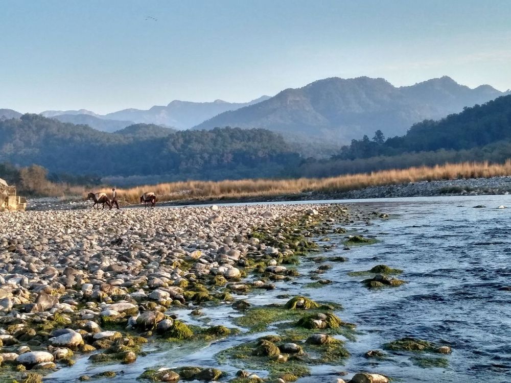
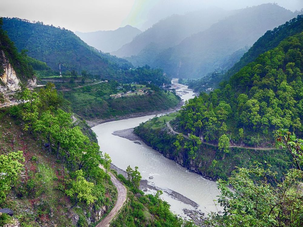
The Bhabar, a strip of land with gently sloping mass that contains mainly riverine debris (coarse gravels), is just below the hilly tract. It is here that the mountain streams descending from the outer ranges and Siwalik hills lose their flow amidst strewn boulders, and re-appear only during the monsoons. It is forested (sal), with many of the forests now having given way to cultivated areas. The rest of the foothills are known as Tarai grassland region, which is primarily moist plain land with the Tarai springs that keep the area perennially hydrated and fertile. Tarai vegetation is characterised by tracts of clayey swamp (Gangetic alluvium), tall grasslands, deciduous forests, and scrub savannah. The three main rivers in Kumaon division are the Kosi, Gola, and Nandhaur. The Kosi river (or Kaushiki, as named in Skandapurana) starts from Dharapani in Almora district, while the Gola and Nandhaur arise from somewhere in the southern slopes of the outer hills. All the three rivers, and other smaller streams in the Bhabar and Tarai areas all drain into the Ramganga. The other major river on the Nepal-Kumaon border is the Sharda river (also known as the Kali Ganga or Maha Kali) that descends from the Kalapani territory, and joins the Ghaghra/Karnali river in the state of Uttar Pradesh.
Kosi River, Jim Corbett National Park, Ramnagar- Almora district (Photo from Wikipedia)Sharda or Mahakali River near Jauljibi in Pithoragarh district of Kumaon (photo source: Wikipedia
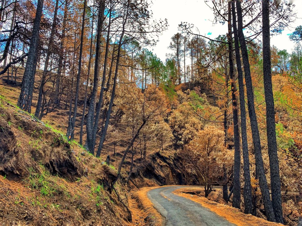
The lower sub-Himalayan ranges show Upper Tertiary era deposits of Nahan sandstone, while the higher ranges are made of older slate, quartzite, dark dolomite or limestone, and other schistose and granite rocks. Owing to the heavy rainfalls experienced in these areas the steep slopes often give way to massive landslides. Kumaon, which is situated on the southern slope of the Himalayan range, show great variations in climate and vegetation that change drastically with changes in elevation, ranging from glaciers at its highest elevations, to subtropical forests at the lower elevations, to grasslands at the flat lands on foothills. While travelling in car these changes are clearly visible, as one moves from the lowlands of Terai that show mostly grasslands, and Bhabar with its remaining pockets of sal forests; to the higher hills that are filled with coniferous and broad-leaf forests, alpine shrubs, and meadows; and finally to the snowy peaks of the Upper Himalaya.
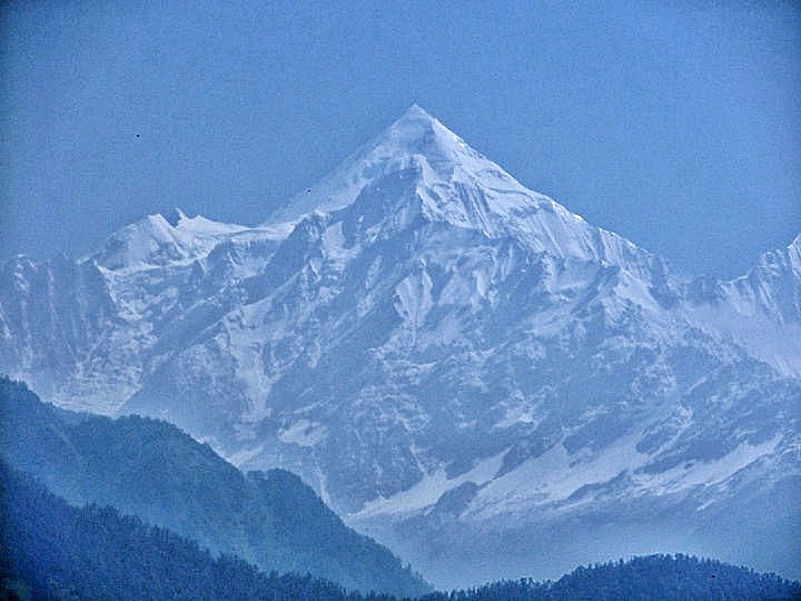
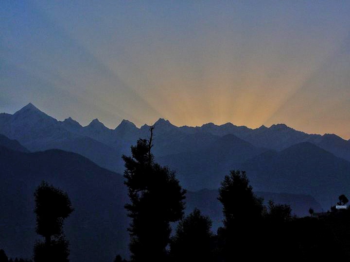
Sunrise from behind the snowy peaks of the Panchachulli range, Kumaon
Origin of the name Kumaon
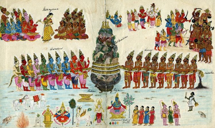
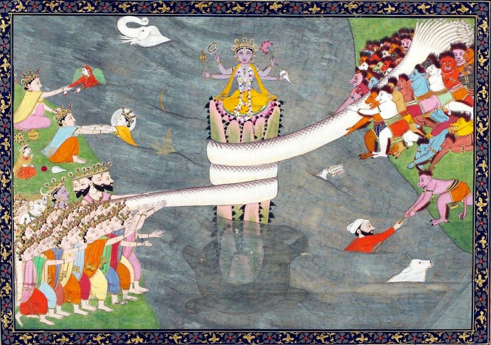
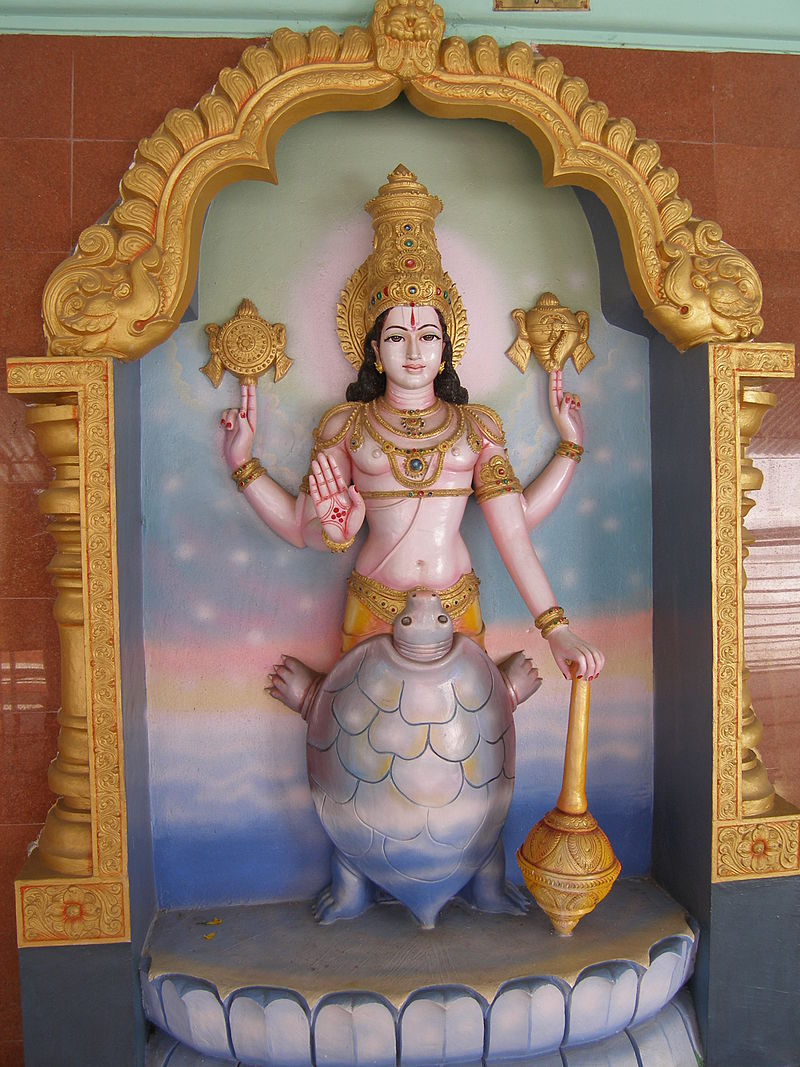
A look at the history of this area shows that the SkandaPurana (Manash Khanda) refers to this part as Kurmavana or Kumaravana; and it is believed that the word Kumaon is a corruption of the original Puranic term. According to folklore, Vishnu had reincarnated here in Kumaun (near Lohaghat) as Kurma (his second incarnation), to support the Mandar mountain during samudramanthan.
Kurma Avatar of Vishnu, below Mount Mandara, with Vasuki wrapped around the mountain, during Samudra Manthan. ca 1870. (Photo from Wikipedia)Kurmavatara of Lord Vishnu at Narayana Tirumala (Photo from Wikipedia). Kurma in the Vedic texts symbolises the importance of basic principles and the support necessary for any long term creative activity. In Shatapatha Brahmana (6.1.1 and 7.5.1) Kurma’s shape represents the hemispherical shape (assumed) of the earth, and it is for this reason kurma shape is one among the Vedic fire altar designs.
According to Kumaoni folklore, Vishnu in his kurma avataarstood here for three years on the Kurma-mountain (Kandadeva or Kandeva), which is on the east of the river Champavat, and marks of the tortoise’s feet still remain as imprints. It is for this reason that the region came to be known as Kurma + achal or Kurmachal, which got morphed into Kumu, and later to Kumaon. Initially only the areas around river Champavat were known as Kumaon, but later the whole pargana of Kali Kumaon that comprised of villages along the Kali river came to be known as Kumaon. Later during the reign of Chand dynasty, the entire region, which included the districts of Nainital and Almora, was renamed as Kurmachal or Kumaun. During British rule the Dehradun district also was included in Kumaun.
It was the Chand dynasty rulers who made the term Kurmachal or Kumaon widely popular in this hill state, and prior to their reign there are no mentions of Kurmachal or Kumaon in any of the inscriptions found. The Chands used Kurmachal in all their records. Under their rule that lasted from 11th c. CE to 1815 CE, there were three administrative divisions in Kurmachal:
(i) Kali Kumaun, (ii) Almora, and (iii) Tarai Bhawar or Mal.
Interestingly, while most believe that the term Kurmachal was derived from Kurma, Thakur Jodh Singh Negi in his Himalayan Bhraman had opined that as the people of Kumaon were expert farmers and also quite wealthy, so this region came to be known as Kumaon, derived from the local dialect kumuno, which means a cultivated land. He further theorised that the region Kali Kumaon was named not after the river Kali but after Kalu Tadagi who had once ruled the area, and owing to the presence of thick black bushes of fir and banjha, the adjective ‘Kali’ got added to it. While these theories may provide some interesting viewpoints, they are certainly not based on any historical evidences. Linguistically too, Kumaon as a derivation from Kurmachal appears more logical.
Currently Almora, Bageshwar, Champawat, Nainital, Pithoragarh, and Udham Singh Nagar form the Kumaun division; however, linguistically Kumaon can be further sub divided. Thus, we find that Kali (or Central) Kumaoni dialect is spoken in Almora and northern Nainital, while North-eastern Kumaoni dialect is used in Pithoragarh. South-eastern Kumaoni is spoken in South-eastern Nainital, and Western Kumaoni is spoken west of Almora and Nainital.
While originally the people of Kali Kumaoni were the only Kumaonis, with the Nainital and Almora people being later additions; yet the people from Gangoli and Chaugarkha that are parts of Kali Kumaon, are not termed as Kumaonis, but are called Gangolas and Chaugarikhiyas.
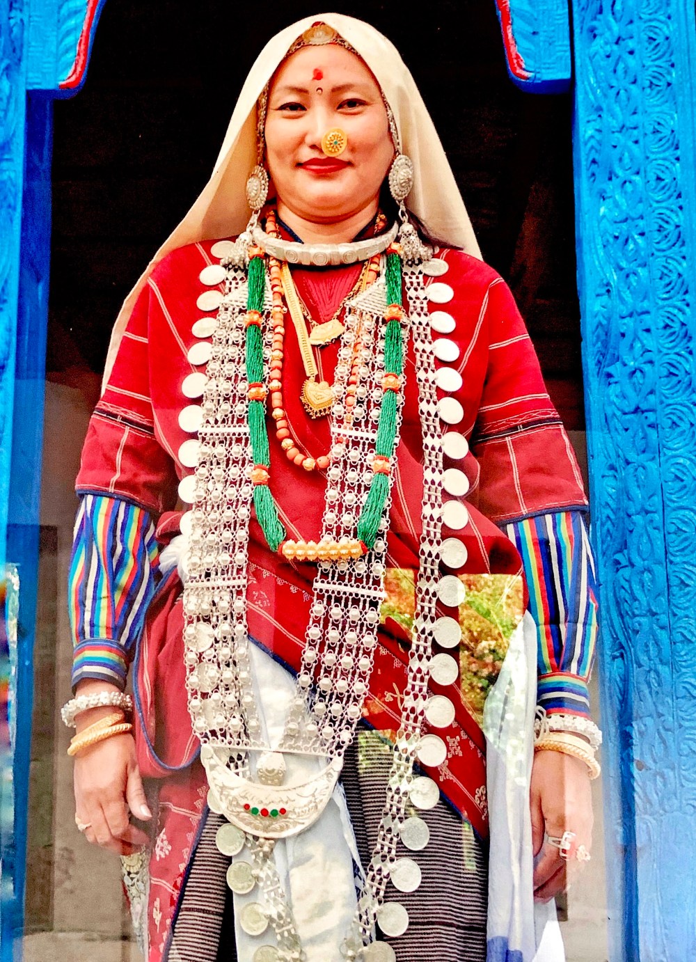
A Kumoani woman in full traditional attire and jewellery (photo from KMVN – Binsar). The common daily wear is now of course a saree, for more practical reasons suitable for a working woman.
Kumaon history
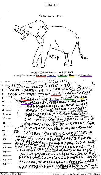
The archaeology based history of the region remained sketchy for quite some time owing to disjointed facts and sporadic records that were available until the 19th century CE. In terms of literary history, the region finds many fleeting references in the epics and the Puranas. Mahabharata mentions this area frequently, especially where it talks of the Kiratas who lived near the sources of the Ganga and Yamuna. The Khasas or Khasiascome next, who are found mentioned in the Mahabharata as living in the same areas as the Kiratas. Pliny mentioned Casiri, which many historians identify as the Khasias. Herodotus also mentioned of people living in this area as “Indians who lived in the city of Kaspatyrus.” Ptolemy had written about a group of people living in this area, which Cunningham studied extensively and identified them with the Kulindas of Mahabharata. The Yaudheyas (5th c. BCE – 4th c. CE), a military confederation, had also ruled this area at some point of time, as evident from the coins found. The Kalsi rock edicts of Ashoka (260 – 230 BCE), discovered by Alexander Cunningham in 1850, are important pieces of archaeological evidences that mention the people living in this region.
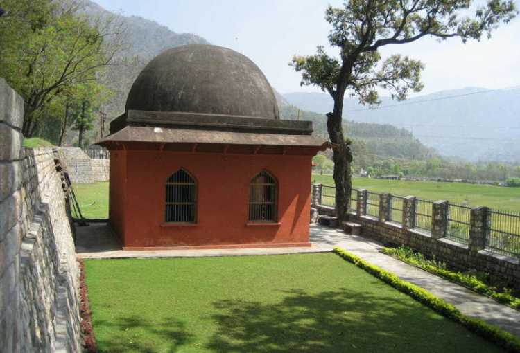
Edict No13 of Ashoka, Khalsi inscription, with the identification of Hellenistic kings Antiochos II, Ptolemy II, Antigonos II Gonatas, Magas of Cyrene and Alexander II of Epirus. these edicts were found in Khalsi in Dehradun district. (photo from Wikipedia)The Kalsi inscriptions are now housed in this room and maintained by the ASI. (photo from the internet). Kalsi is a small town located between Chakrata and Dehradun near Dakpatthar on the banks of Yamuna. The
It is believed by D. R. Bhandarkar that the Khasas were the first to settle in the hilly tract of Uttarakhand, followed by the Gurjaras who came in after 6th c. CE and took over Sapadlaksha (the area around Shivalik ranges stretching from Hoshiyarpur -Punjab to Kumaon), and it is from here that the Gurjaras later moved down to what is now the state of Rajasthan.
ET Atkinson had done some extensive researches on the available cultural, social, and historical data of the area, and had recorded it in his pioneering work titled “Himalayan Districts of the North-Western provinces of India,” published in 1884. Later discoveries and studies of the various inscriptions such as the Jageswar inscriptions, Lakhamandal inscriptions, the two Talesvara Copper Plate, and Pandukesvar inscriptions have given some significant insights into the 6th-7th CE history of the area. There are many more such later period research works on this arena by Rahul Sankrityayan, H.K. Raturi, S.P. Dabral, and B.D. Pande.
Much later, extensive studies of fossil remains found from rocks in this region that date back to 18.3 to 0.6 million years BP have opened up a vista of the prehistoric era as had existed here. The fossil studies have revealed “a variety of Stresirhine Primate genera, Cercopithecoid genera, and Hominoid genera, the last one being of special interest to hominid ancestry. Significantly, Kalagarh Basin (District Pauri, Uttarakhand) has also witnessed Hominoid activities some 11 to 10 million years ago. These include Sivapithecus indicus and Ramapithecus punjabicus. These hominoids form important links in the evolution of hominids” (Archaeological Survey of India, Dehradun circle). Furthermore, the recent discoveries of “Palaeolithic era tools from Potwar (northern Pakistan) dated between 2.4 and 2.0 million years BP, and from Uttarbaini (Jammu and Kashmir, India) dated between 2.5n and 0-5 million years BP” have given rise to the theory that the Himalayan region could have been the cradle of the earliest hominids of the world.
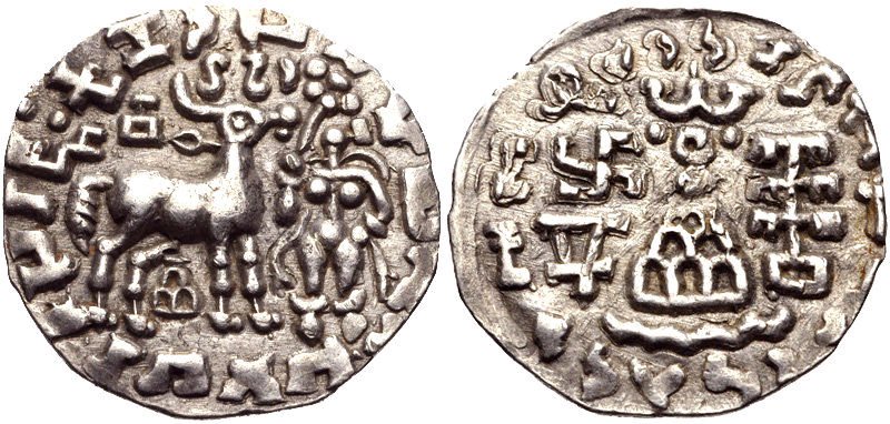
Recent archaeological studies of this region have given an insight into the different technological stages of human evolution ranging from the Stone to Copper, and Iron Ages (pre-and protohistoric periods). Meanwhile the historical studies from different numismatic, literary, and epigraphical evidences, give us the names of some of the important dynasties that have ruled this area. These include the Kunindas (2nd BCE to 4th c. CE); while in the 4th CE we find that the area was known as Karttripura kingdom, a vassal kingdom under the Guptas (as written in Samudra Gupta’s Parayaga Prasasti).
Silver coin of the Kuninda Kingdom, c. 1st century BCE. (photo from Wikipedia)
The rich ancient history of Uttarakhand was further revealed when in a recent survey, temple remains were discovered in Yandhura, in Champawat district. Interestingly, a 1st century BCE built red sandstone vedika pillar was found here that had figures of humans, ganas, yaksha, and yakshi engraved on it. Besides this, many large images of yakshas have also been found from various sites in Dwaraghat, Podhar, Baijnath and Dashyu in Uttarakhand. It is believed that these ancient temples, which were made entirely of wood, eventually got destroyed through natural decaying. To avoid this, from the post-Gupta period under the Katyuris, stones were used in constructing temples that were often built over the ruined wooden ones.
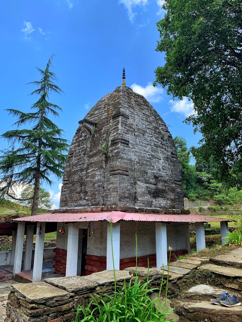
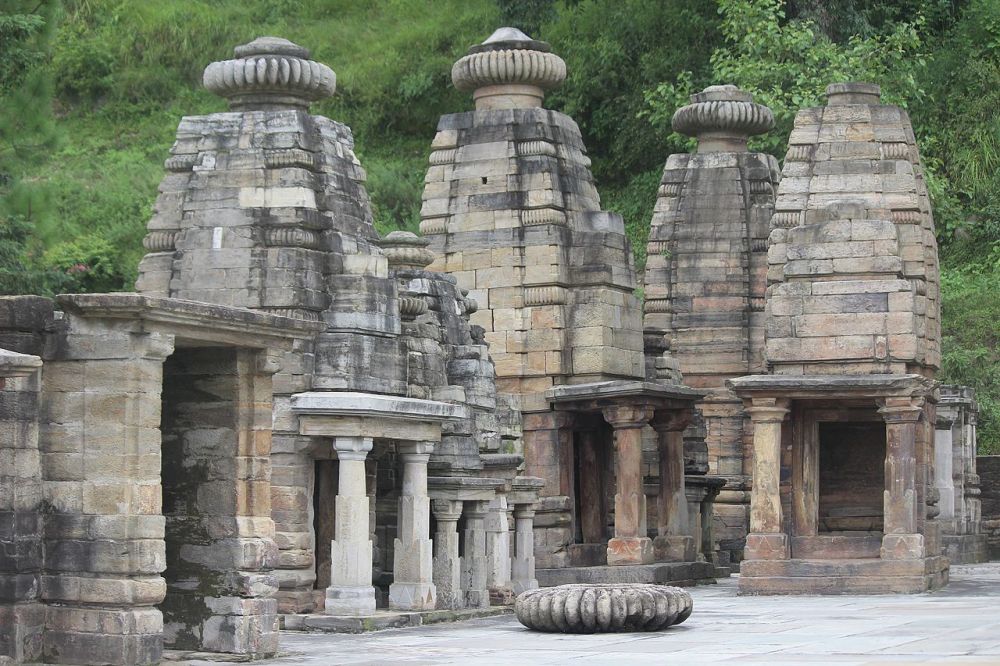
From the Talesvara Copper Plate Inscriptions of Almora we find that this region was called Brahmapura in the 6th-7th c. CE, during the reign of the Paurava-Varmans. The name Brahmapura is found in the Vrihatsamhita, while Heiun Tsang also mentions it in his 7th c. CE travel book (he writes it as as Po-lo-hi-mo-pu-lo, that in Sanskrit translates to Brahmapura). The kingdom of Brahmapura declined by the end of 8th c. CE, and next came the Katyuris, who ruled from 9th -12th c. CE. From various inscriptions it is clear that some parts of this area came under the dominion of the Mallas of Nepal from 1191 CE to 1223 CE, and that effectively ended the Katyuri rule, though later inscriptions show that the Katyuris survived as petty rulers of smaller areas. After the Katyuris, eventually from 11th century onward emerged the most powerful dynasty of Kumaon, the Chand dynasty, who kept control until 1815. The British conquered it in 1815 and took over the area, which remained with them until 1947.
Katarmal sun temple built by the Katyuris in 9th c.CEBineswara temple built by the Chand dynasty in 16th c. CEJageswara temple cluster. Built between 7th to 12th CE, with renovations going up to 17th century under the Chand dynasty
References
Pande, B. D. History of Kumaon: English version of “Kumaon ka itihas”. Almora, U.P., India: Shyam Prakashan: Shree Almora Book Depot, 1993.
Omacanda Hāṇḍā, History of Uttaranchal. Indus Publishing, 2002.
Kanti Prasad Nautiyal, The Archaeological of Kumaon, 1969.
Alexander Cunningham, Archaeological Survey Report, vol. II.
Bhandarkar, D. R. Gurjaras (Art.), J B B R S, Vol. XXI,1903.
Hermann Goetz, Studies in the History and Arts of Kashmir and the Indian Himalayas, Weisbaden, 1969.
This is such a beautiful write up. The background research work is seen in every little detail of history described here.
Excellent read. Keep it up Monidipa.


This is such a beautiful write up. The background research work is seen in every little detail of history described here.
Excellent read. Keep it up Monidipa.
LikeLiked by 1 person
Thank you 😊😊
LikeLike
Lovely read.
LikeLiked by 1 person
Thank you 😊
LikeLike